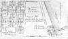
The map of Highland Park and vicinity was compiled by Windes and Marsh, civil engineers and surveyors. The map is color coded. The date on the map is 1934. However, there is a note: P.E. Cole, city engineer, January 1938. The atlas of the city of Highland Park, Lake County Index sheet shows a street index of Highland Park that is color coded. The index sheet was drawn in 1932 by D.D. Corrough and P.E. Cole and revised 26 Feb 1939 by Corrough and 18 July 1939 by P.E. Cole.
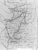
The map shows Highland Park and its vicinity. This map has been revised three times: June 3, 1955 by NJP, April 6, 1962 by PEC, and March 2, 1965 by CAM and JLH. The map includes dis-annexed and annexed ordinances and the dates they were passed. The map is presented on vinyl-like material that is translucent.