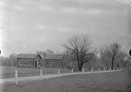
Lincoln-Berry store and another building
- US IlHpHS 1996.5-0432
- Item
- 1931-04-19
Slide Reads: Lincoln/Berry store and another building, New Salem; 1931/04/19
2473 results with digital objects Show results with digital objects
Lincoln-Berry store and another building
Slide Reads: Lincoln/Berry store and another building, New Salem; 1931/04/19
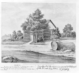
Lincoln's Illinois Home-Sangamon River
Slide Reads:
Lincoln's Illinois Home--Sangamon River.
Part of Individual file
Linden ave: 1259, 1940, 1942, 2285
Part of House file
Linden Avenue Improvements--Correspondence, Plan of Culvert
Part of Records
Linden Park Place: 160, 218, 224, 243, 274, 275, 282, 285, 296
Part of House file

Hand-colored photograph of a Linden (Tillia Americana).
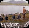
Line of 25th Battery and “C” Company 27th Infantry in front of Fort Bacolod : April 8, 1903
Lions Club of Highland Park -- Highwood, Illinois
Anniversary (25th and 70th) monographs, event photographs and clippings.
Lions Club of Highland Park-Highwood (Ill.).
Part of Leo C. Grotti family, papers